PhilSA Signs New Agreements to Boost Space Data Use for Environmental Protection
The Philippine Space Agency (PhilSA) has formalized new strategic partnerships with the Palawan Council for Sustainable Development (PCSD) and the Tubbataha Management Office (TMO) to expand the use of space-based data in environmental protection and sustainable development initiatives across Palawan.
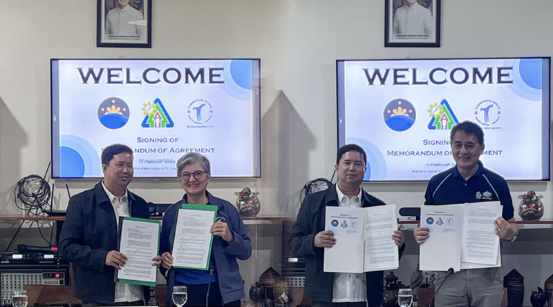
The agreements were signed on February 13, 2026, in Puerto Princesa City through separate five-year Memoranda of Agreement (MOA) at the PCSD Building. Signatories included PCSD Executive Director Atty. Teodoro Matta, TMO Protected Area Superintendent Angelique Songco, and PhilSA Director General Gay Jane P. Perez, Ph.D., represented by Space Information Infrastructure Bureau Director Ariel C. Blanco, Ph.D.
Satellite Mapping to Support Sustainable Development
Under the MOA with PCSD, PhilSA will generate land use and land cover (LULC) maps, as well as benthic or marine habitat maps, at no cost. These outputs will strengthen environmental monitoring, assess ecological damage, and support evidence-based planning across Palawan.
PCSD, in turn, will assist in validating the satellite-generated outputs using ground data, ensuring the accuracy and reliability of the maps for policymaking and conservation programs.
The partnership builds on earlier collaboration through the PhilSA Integrated Network for Space-Enabled Actions (PINAS) Workshop held in Palawan in 2022. Launched in October 2022, PINAS serves as a growing network of local government units, institutions, and stakeholders leveraging space data for sustainability initiatives. Workshops have since been conducted in multiple regions nationwide, expanding the reach of space-enabled solutions at the local level.
Strengthening Protection of Tubbataha Reefs
In a separate agreement, PhilSA and the TMO formalized cooperation to conduct benthic and bathymetry mapping within the Tubbataha Reefs Natural Park, a UNESCO World Heritage Site recognized as one of the country’s most important marine biodiversity areas.
The mapping initiative will support science-based management of the protected area, providing updated spatial data to guide conservation decisions and long-term ecological monitoring.
Capacity Building and Field Validation
Beyond map production, the agreements include capacity-building components to enable PCSD and TMO personnel to independently use space-borne data for habitat monitoring and resource management beyond the five-year partnership period.
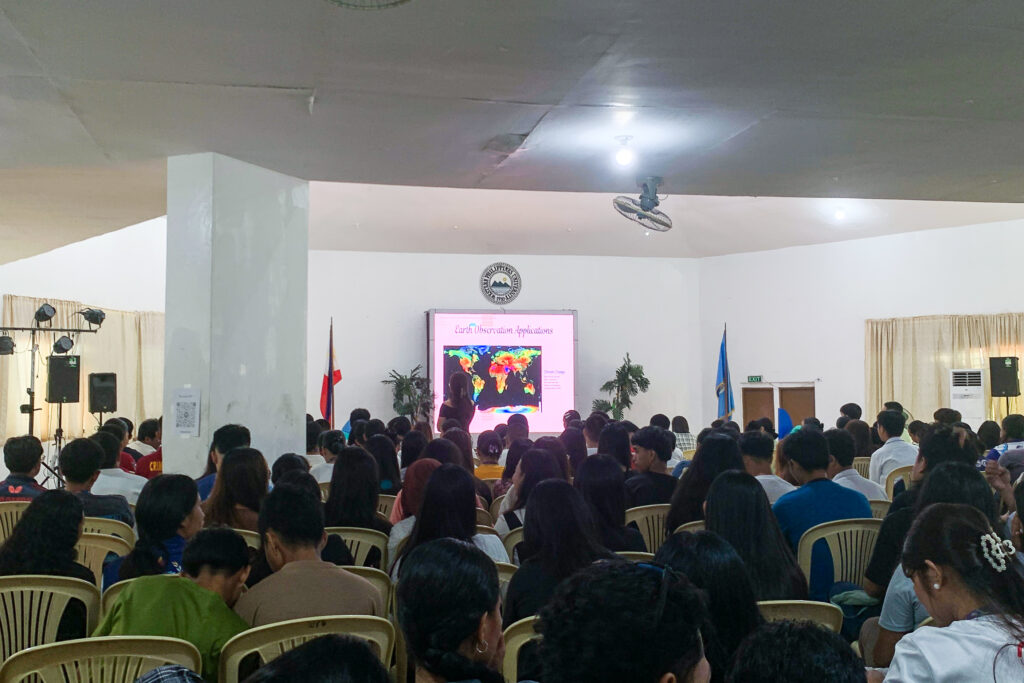
In parallel with the MOA signing, PhilSA conducted PINAS symposiums at Western Philippines University and Palawan State University, alongside field surveys in Balabac, Palawan. These activities involved drone image acquisition for high-resolution benthic, crop, and land cover mapping, as well as underwater video and echosounder tows to collect bathymetric data.
The information gathered will help produce more accurate seagrass, coral, forest, and crop maps, supporting agriculture planning, biodiversity protection, and sustainable development strategies in the province.
Advancing Space-Enabled Environmental Governance
Through these agreements, PhilSA continues to institutionalize the use of space science, technology, and applications (SSTA) in local environmental governance. The partnerships with PCSD and TMO highlight how satellite data, combined with ground validation and capacity development, can strengthen conservation outcomes in ecologically critical regions like Palawan and Tubbataha.
The move reinforces PhilSA’s broader mandate to integrate space-enabled solutions into national and local development efforts, positioning data-driven decision-making at the forefront of environmental protection in the Philippines.